Approximate Location Map
Large Map »
Latitude: 52.3368 / 52°20'12"N
Longitude: -2.2917 / 2°17'30"W
OS Eastings: 380218
OS Northings: 271013
OS Grid: SO802710
Mapcode National: GBR 0BZ.HDJ
Mapcode Global: VH920.7J9F
Plus Code: 9C4V8PP5+P8
Entry Name: Chest Tombs in Churchyard Circa 5 Metres South East of Church
Listing Date: 11 October 1991
Grade: II
Source: Historic England
Source ID: 1292186
English Heritage Legacy ID: 393380
ID on this website: 101292186
Location: St Bartholomew's Church, Areley Kings, Wyre Forest, Worcestershire, DY13
County: Worcestershire
District: Wyre Forest
Civil Parish: Stourport-on-Severn
Built-Up Area: Stourport-on-Severn
Traditional County: Worcestershire
Lieutenancy Area (Ceremonial County): Worcestershire
Church of England Parish: Areley Kings
Church of England Diocese: Worcester
Tagged with: Chest tomb
STOURPORT ON SEVERN
SO8071SW RECTORY LANE, Areley Kings
589-1/7/88 (North West side)
Chest Tombs in Churchyard circa 5m
SE of church
GV II
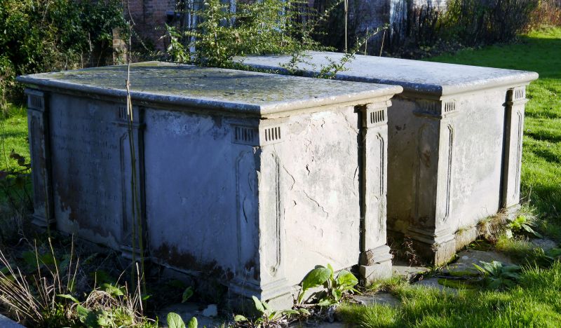
Pair of chest tombs, inscribed in memory of members of the
Crane family (d.1791 -1806). Stone, carried on a common base,
each tomb has pilasters at angles and centres of long sides,
with fluted capitals and moulded panels.
Listing NGR: SO8021871013
External links are from the relevant listing authority and, where applicable, Wikidata. Wikidata IDs may be related buildings as well as this specific building. If you want to add or update a link, you will need to do so by editing the Wikidata entry.


Other nearby listed buildings
