Approximate Location Map
Large Map »
Latitude: 54.2324 / 54°13'56"N
Longitude: -0.7227 / 0°43'21"W
OS Eastings: 483355
OS Northings: 482608
OS Grid: SE833826
Mapcode National: GBR RMDH.BK
Mapcode Global: WHF9X.WW07
Plus Code: 9C6X67JG+XW
Entry Name: Brookfield
Listing Date: 5 February 1986
Grade: II
Source: Historic England
Source ID: 1241309
English Heritage Legacy ID: 440314
ID on this website: 101241309
Location: Thornton-le-Dale, North Yorkshire, YO18
County: North Yorkshire
District: Ryedale
Civil Parish: Thornton-le-Dale
Built-Up Area: Thornton-le-Dale
Traditional County: Yorkshire
Lieutenancy Area (Ceremonial County): North Yorkshire
Tagged with: Building
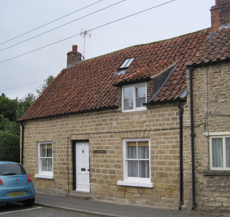
THORNTON DALE MALTONGATE
SE 8382
(west side)
15/133 Brookfield
GV II
House. Late C18, with later alteration and extension. Dressed sandstone,
some herringbone-tooled; left gable partly rendered; pantile roof; rebuilt
brick stacks. 2-cell direct-entry plan; outshut added. Single storey and
attic, 3-bay front. Off centre C20 4-panel door, flanked by later inserted
4-pane sashes with stone sills, all with flat arches. Single raking dormer
with 2-light, large-pane horizontal sliding sash to attic. End stacks.
Listing NGR: SE8335582608
External links are from the relevant listing authority and, where applicable, Wikidata. Wikidata IDs may be related buildings as well as this specific building. If you want to add or update a link, you will need to do so by editing the Wikidata entry.


Other nearby listed buildings
