Latitude: 52.3374 / 52°20'14"N
Longitude: -2.2797 / 2°16'46"W
OS Eastings: 381042
OS Northings: 271067
OS Grid: SO810710
Mapcode National: GBR 0C0.DGJ
Mapcode Global: VH920.FJP1
Plus Code: 9C4V8PPC+W4
Entry Name: Canal Maintenance Buildings and Lock Cottage
Listing Date: 9 November 1971
Grade: II
Source: Historic England
Source ID: 1292376
English Heritage Legacy ID: 393322
ID on this website: 101292376
Location: Stourport-on-Severn, Wyre Forest, Worcestershire, DY13
County: Worcestershire
District: Wyre Forest
Civil Parish: Stourport-on-Severn
Built-Up Area: Stourport-on-Severn
Traditional County: Worcestershire
Lieutenancy Area (Ceremonial County): Worcestershire
Church of England Parish: Stourport-on-Severn and Wilden
Church of England Diocese: Worcester
Tagged with: Cottage
STOURPORT ON SEVERN
SO8171SW ENGINE LANE 589-1/9/15 (North East side) Canal Maintenance Buildings and Lock Cottage
GV II
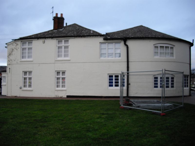
Canal maintenance building, formerly iron warehouse, and adjoining dwelling. c1776 but extended in early C19. Painted brick with Welsh slate roof. Original warehouse range to north is 2-storeyed, though largely open to roof and with an inserted floor in part of the structure. 3 bays with round-arched central doorway and casement windows with cambered brick heads in north elevation. Curved corner to NW. Coped SE gable with blocked oculus. Extended towards the south circa 1800, in a hipped roofed wing with rounded corners, and wide casement windows in south elevation (one blocked). Early C19 added wing adjoining and parallel with this, probably always in domestic use, has paired windows with flat arched heads. Blocked doorway between the wings, the present doorway in added porch to west. NW elevation of warehouse has giant opening now partly glazed. Dentilled eaves bands throughout. Interior of northern range has king-post roof with 6 trusses radiating from a single pilaster, spanning the full height curved space.
Listing NGR: SO8104271067
External links are from the relevant listing authority and, where applicable, Wikidata. Wikidata IDs may be related buildings as well as this specific building. If you want to add or update a link, you will need to do so by editing the Wikidata entry.


Other nearby listed buildings