Latitude: 52.3372 / 52°20'13"N
Longitude: -2.2801 / 2°16'48"W
OS Eastings: 381011
OS Northings: 271050
OS Grid: SO810710
Mapcode National: GBR 0C0.DC9
Mapcode Global: VH920.FJG4
Plus Code: 9C4V8PP9+VX
Entry Name: Canal Basins, Locks and Wharves
Listing Date: 5 July 1950
Grade: II
Source: Historic England
Source ID: 1209441
English Heritage Legacy ID: 393302
ID on this website: 101209441
Location: Stourport-on-Severn, Wyre Forest, Worcestershire, DY13
County: Worcestershire
District: Wyre Forest
Civil Parish: Stourport-on-Severn
Built-Up Area: Stourport-on-Severn
Traditional County: Worcestershire
Lieutenancy Area (Ceremonial County): Worcestershire
Church of England Parish: Stourport-on-Severn and Wilden
Church of England Diocese: Worcester
Tagged with: Architectural structure
STOURPORT ON SEVERN
SO8071SE Canal Basins, Locks and Wharves
589-1/8/1
05/07/50
(Formerly Listed as:
Canal Basins and Locks)
GV II
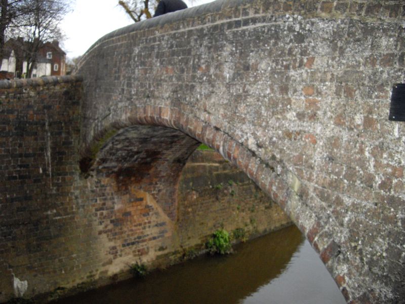
Canal basins, locks and wharves, built by the Staffordshire
and Worcestershire Canal Company from 1766. James Brindley was
the principal engineer. Original construction was stone and
brick for basin and lock walls, timber lock gates, stone wharf
walls. Much of this has now been repaired or renewed, though
the battered stone walls of the lock entrances remain and the
wharf walls survive largely intact. Canal enters by York
Street Lock in NE corner of Upper Basin, which was completed
in 1771. It still contains a small dock inlet in the north
section. Channel links this basin to Old Basin of 1782 to the
west, and locks south from each basin link to the lower basins
of 1771 and 1775. Dry dock entered from western lower basin,
and narrow boat locks of 1781 connect it with the river. Barge
locks leave from the eastern lower basin, 1771. Graving docks
also accessed from this basin. Brick and stone bridges
formerly crossed the locks linking upper and lower basins: the
eastern bridge survives substantially, though one parapet has
been renewed. A small cast-iron bridge (early C20?) crosses
the top of the narrow boat locks, and a brick bridge crosses
at the bottom. Wharf walls of coursed and squared sandstone
extend along the river between the two sets of locks, and
eastward for some 100 m., also probably late C18.
(Porteous J D: Canal Ports: The Urban Achievement of the Canal
Age: London: 1977-: 83-105).
Listing NGR: SO8101171049
External links are from the relevant listing authority and, where applicable, Wikidata. Wikidata IDs may be related buildings as well as this specific building. If you want to add or update a link, you will need to do so by editing the Wikidata entry.


Other nearby listed buildings