Approximate Location Map
Large Map »
Latitude: 52.3367 / 52°20'12"N
Longitude: -2.2791 / 2°16'44"W
OS Eastings: 381077
OS Northings: 270990
OS Grid: SO810709
Mapcode National: GBR 0C0.DM5
Mapcode Global: VH920.FJZK
Plus Code: 9C4V8PPC+M8
Entry Name: Former Stabling for Tontine Hotel
Listing Date: 11 October 1991
Grade: II
Source: Historic England
Source ID: 1292169
English Heritage Legacy ID: 393388
ID on this website: 101292169
Location: Stourport-on-Severn, Wyre Forest, Worcestershire, DY13
County: Worcestershire
District: Wyre Forest
Civil Parish: Stourport-on-Severn
Built-Up Area: Stourport-on-Severn
Traditional County: Worcestershire
Lieutenancy Area (Ceremonial County): Worcestershire
Church of England Parish: Stourport-on-Severn and Wilden
Church of England Diocese: Worcester
Tagged with: Hotel
STOURPORT ON SEVERN
SO8170NW SEVERNSIDE
589-1/13/71 (East side)
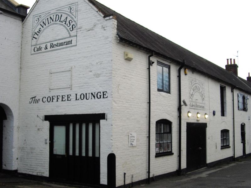
Former stabling for Tontine Hotel
GV II
Former stable block to Tontine Hotel. c1800. Painted brick
with Welsh slate roof. 2-storeyed, 4 bays, with range of 3
wide doorways, 2 now blocked and with inserted windows, and an
inserted doorway to right. Single window survives to right,
with cambered brick head. Loading door to upper floor, and 2
windows aligning with lower openings. That to left forms part
of 2 Severnside (q.v.). Coped gable to north, corbelled out.
Included for group value.
Listing NGR: SO8107770990
External links are from the relevant listing authority and, where applicable, Wikidata. Wikidata IDs may be related buildings as well as this specific building. If you want to add or update a link, you will need to do so by editing the Wikidata entry.


Other nearby listed buildings
