Approximate Location Map
Large Map »
Latitude: 52.3364 / 52°20'11"N
Longitude: -2.2794 / 2°16'45"W
OS Eastings: 381061
OS Northings: 270963
OS Grid: SO810709
Mapcode National: GBR 0C0.DK1
Mapcode Global: VH920.FJVR
Plus Code: 9C4V8PPC+H7
Entry Name: 4, Severnside
Listing Date: 9 November 1971
Last Amended: 11 October 1991
Grade: II
Source: Historic England
Source ID: 1217988
English Heritage Legacy ID: 393386
ID on this website: 101217988
Location: Stourport-on-Severn, Wyre Forest, Worcestershire, DY13
County: Worcestershire
District: Wyre Forest
Civil Parish: Stourport-on-Severn
Built-Up Area: Stourport-on-Severn
Traditional County: Worcestershire
Lieutenancy Area (Ceremonial County): Worcestershire
Church of England Parish: Stourport-on-Severn and Wilden
Church of England Diocese: Worcester
Tagged with: Building
STOURPORT ON SEVERN
SO8170NW SEVERNSIDE
589-1/13/69 (East side)
09/11/71 No.4
(Formerly Listed as:
SEVERN SIDE
Nos.4-7 (Consecutive))
GV II
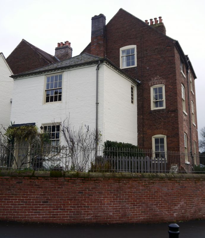
House, built against back wing of No.5 Severnside. c1820.
Painted brick with hipped Welsh slate roof. 2-storeyed,
single-unit plan with doorway to left, a 6-panelled door with
console brackets supporting entablature. 16-pane sash windows
on each floor, the lower with flat arched brick head.
Dentilled eaves band, rear stack.
Listing NGR: SO8106370964
External links are from the relevant listing authority and, where applicable, Wikidata. Wikidata IDs may be related buildings as well as this specific building. If you want to add or update a link, you will need to do so by editing the Wikidata entry.


Other nearby listed buildings
