Latitude: 50.2332 / 50°13'59"N
Longitude: -5.1809 / 5°10'51"W
OS Eastings: 173248
OS Northings: 41864
OS Grid: SW732418
Mapcode National: GBR Z6.1J5P
Mapcode Global: FRA 081D.TP5
Plus Code: 9C2P6RM9+7J
Entry Name: Pound at SW 732 418
Listing Date: 12 September 1989
Grade: II
Source: Historic England
Source ID: 1328194
English Heritage Legacy ID: 66899
ID on this website: 101328194
Location: Carharrack, Cornwall, TR16
County: Cornwall
Civil Parish: St. Day
Traditional County: Cornwall
Lieutenancy Area (Ceremonial County): Cornwall
Church of England Parish: St Day
Church of England Diocese: Truro
Tagged with: Animal pound
SW 74 SW
6/334
ST DAY
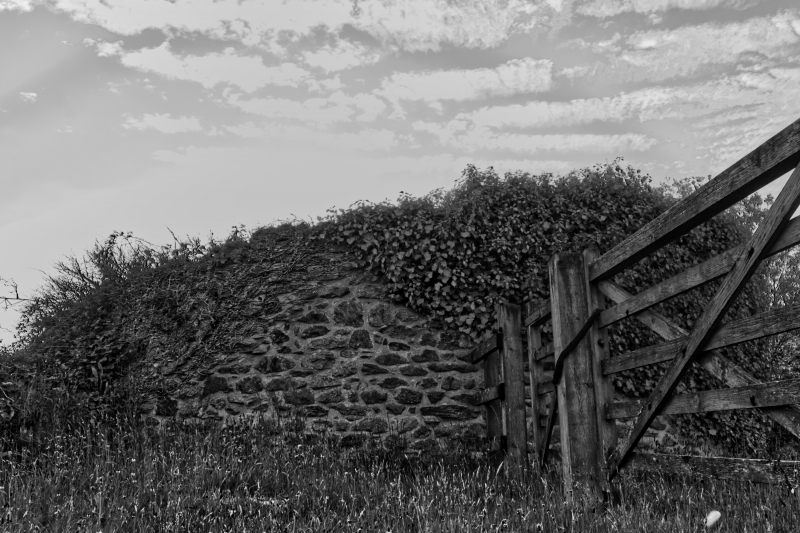
Pound at SW 732 418
II
Parish pound. 1839, for Gwennap Parish. Uncoursed rubble. Circular plan, approx.
10 metres in diameter, with wall approx. 3 metres high. Now partly enclosed by
attached modern sheds, and roofed with corrugated sheet.
Listing NGR: SW7324841864
External links are from the relevant listing authority and, where applicable, Wikidata. Wikidata IDs may be related buildings as well as this specific building. If you want to add or update a link, you will need to do so by editing the Wikidata entry.


Other nearby listed buildings