Latitude: 53.7952 / 53°47'42"N
Longitude: -1.5351 / 1°32'6"W
OS Eastings: 430721
OS Northings: 433310
OS Grid: SE307333
Mapcode National: GBR BLM.T9
Mapcode Global: WHC9D.DV7X
Plus Code: 9C5WQFW7+3X
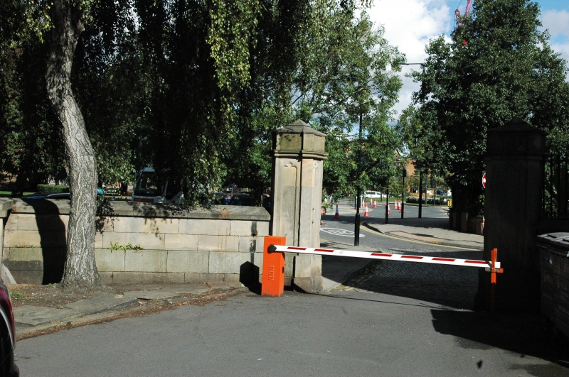
Entry Name: Gateway and Boundary Wall to East of Parish Church of St Peter
Listing Date: 8 May 1974
Last Amended: 11 September 1996
Grade: II
Source: Historic England
Source ID: 1375047
English Heritage Legacy ID: 465927
ID on this website: 101375047
Location: Steander, Leeds, West Yorkshire, LS2
County: Leeds
Electoral Ward/Division: City and Hunslet
Parish: Non Civil Parish
Built-Up Area: Leeds
Traditional County: Yorkshire
Lieutenancy Area (Ceremonial County): West Yorkshire
Church of England Parish: Leeds City
Church of England Diocese: Leeds
Tagged with: Gate
LEEDS
SE3033SE KIRKGATE 714-1/79/230 (South side (off)) 08/05/74 Gateway and boundary wall to east of Parish Church of St Peter (Formerly Listed as: KIRKGATE Gate piers NW and SW of St Peter's Church and churchyard wall north and west)
GV II
Remains of gate piers and boundary wall to churchyard. After 1841. Gritstone. Walling: coursed and squared gritstone, cut to ashlar finish. Approx 1m high, 20m long, form as Church Row on W side of Church of St Peter (qv). Gate piers: square section, chamfered plinths and panelled sides, lower parts only remaining, caps missing; for original form see boundary wall to Church Row (qv).
Listing NGR: SE3072233309
External links are from the relevant listing authority and, where applicable, Wikidata. Wikidata IDs may be related buildings as well as this specific building. If you want to add or update a link, you will need to do so by editing the Wikidata entry.


Other nearby listed buildings