Latitude: 53.1864 / 53°11'10"N
Longitude: -2.8915 / 2°53'29"W
OS Eastings: 340523
OS Northings: 365844
OS Grid: SJ405658
Mapcode National: GBR 7B.363Q
Mapcode Global: WH88F.K59L
Plus Code: 9C5V54P5+G9
Entry Name: Peripheral Wall, Gates and Railings to St Marys Churchyard
Listing Date: 6 August 1998
Grade: II
Source: Historic England
Source ID: 1376385
English Heritage Legacy ID: 470380
ID on this website: 101376385
Location: Chester, Cheshire West and Chester, Cheshire, CH1
County: Cheshire West and Chester
Civil Parish: Chester Castle
Built-Up Area: Chester
Traditional County: Cheshire
Lieutenancy Area (Ceremonial County): Cheshire
Church of England Parish: Chester St John the Baptist
Church of England Diocese: Chester
Tagged with: Wall
CHESTER CITY (IM)
SJ4065NE ST MARY'S HILL 595-1/6/341 (South side) Peripheral wall, gates and railings to St Mary's Churchyard
GV II
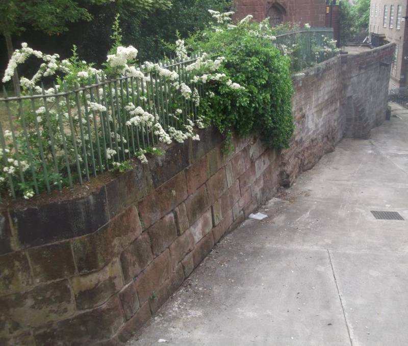
Wall, railings and gates to St Mary's Churchyard. Wall medieval, repaired; gates and railings C19. The churchyard is level with St Mary's Hill to the north, but some 6m above the level of the ground sloping steeply down to the south. The retaining wall is largely of coursed sandstone, with bedrock exposed to south and west and minor repairs in smaller stones and brick; part of the wall is battered; 2 buttresses at south-west corner and recent buttresses to east side. Stone plinth to railings; gabled stone gate piers to iron gates, north, with dogbars, angel-wings and pineapple finials; the steps up were blocked from an iron east gate in 1815 (inscription). Simple iron railings with square bars.
Listing NGR: SJ4052265845
External links are from the relevant listing authority and, where applicable, Wikidata. Wikidata IDs may be related buildings as well as this specific building. If you want to add or update a link, you will need to do so by editing the Wikidata entry.


Other nearby listed buildings