Approximate Location Map
Large Map »
Latitude: 52.1914 / 52°11'29"N
Longitude: -2.2185 / 2°13'6"W
OS Eastings: 385158
OS Northings: 254819
OS Grid: SO851548
Mapcode National: GBR 1G4.PXJ
Mapcode Global: VH92T.H5JX
Plus Code: 9C4V5QRJ+HH
Entry Name: 10, New Street
Listing Date: 5 April 1971
Grade: II
Source: Historic England
Source ID: 1390012
English Heritage Legacy ID: 488963
ID on this website: 101390012
Location: Worcester, Worcestershire, WR1
County: Worcestershire
District: Worcester
Electoral Ward/Division: Cathedral
Parish: Non Civil Parish
Built-Up Area: Worcester
Traditional County: Worcestershire
Lieutenancy Area (Ceremonial County): Worcestershire
Church of England Parish: Worcester, St Martin's in the Cornmarket with St Swithun and St Paul
Church of England Diocese: Worcester
Tagged with: Building
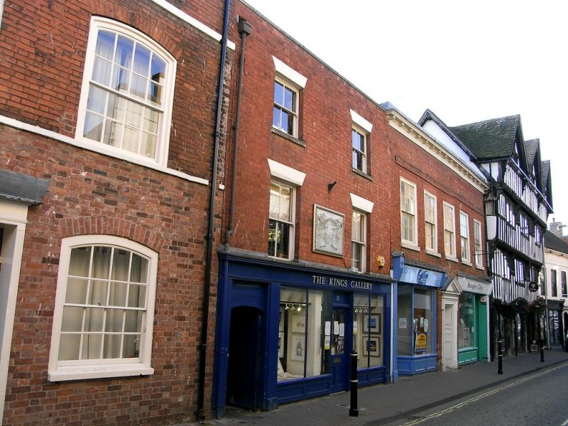
WORCESTER
SO8554NW NEW STREET
620-1/17/450 (East side)
05/04/71 No.10
GV II
House, now shop. Probably late C16 with mid C19 refronting and
C20 shop front. Timber frame with pinkish-red brick facade in
Flemish bond, ashlar copings and lintels, range to rear in
narrow, hand-made pinkish-red brick; plain tile roof.
EXTERIOR: 3 storeys, 2 first-floor windows with ranges to rear.
2/2 sashes in plain reveals and with flat splayed arches, those
to 2nd floor have renewed stone sills. Ground floor: at left a
cambered-arched opening to Nash's Passage, then renewed shop
front with panelled plinth, glazing and off-centre part-glazed
door. Facade to Nash's Passage has exposed square panels of
timber framing.
INTERIOR: square panels of timber frame and jowled posts;
exposed chamfered trenched purlins, collar beam. Remains of a
framed internal wall. Chamfered beams with ogeed stops. Two
stanchions, quatrefoil on section.
HISTORICAL NOTE: New Street had changed its name from the
medieval Glover Street by 1523. Hughes: 'New Street, in its C16
and C17 phase, was a street of dwelling-houses with workshops
behind.'
(Hughes P: Buildings and the Building Trade in Worcester
1540-1650: PhD thesis: 1990-: 200).
External links are from the relevant listing authority and, where applicable, Wikidata. Wikidata IDs may be related buildings as well as this specific building. If you want to add or update a link, you will need to do so by editing the Wikidata entry.


Other nearby listed buildings
