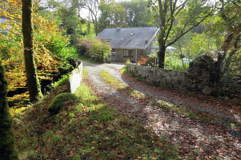
Bridge c200m W of Pont y Pandy
A Grade II Listed Building in Ffestiniog, Gwynedd
Coordinates
Latitude: 52.968 / 52°58'4"N
Longitude: -3.9289 / 3°55'44"W
OS Eastings: 270551
OS Northings: 342919
OS Grid: SH705429
Mapcode National: GBR 5Z.K02H
Mapcode Global: WH55H.MN8K
Plus Code: 9C4RX39C+5C
Entry Name: Bridge c200m W of Pont y Pandy
Listing Date: 24 April 1951
Grade: II
Source: Cadw
Source ID: 4693
Building Class: Transport
ID on this website: 300004693
Location: Situated c200m W of the modern Pont y Pandy on the A470, carrying a minor road over the Afon Teigl, N of Ty Mari Williams.
County: Gwynedd
Community: Ffestiniog
Community: Ffestiniog
Traditional County: Merionethshire
Tagged with:
Bridge
Road bridge
History
Difficult to date, but probably C18, with the parapet altered in the C19.
Exterior
High but narrow single span bridge; rubble construction, with voussoirs to arch, and the probably later parapets formed from single slabs of slate on end and joined by iron ties.
Reasons for Listing
Listed as a distinctive vernacular bridge, particularly notable for the use of slate slabs to form parapets.
External Links
External links are from the relevant listing authority and, where applicable, Wikidata.
Wikidata IDs may be related buildings as well as this specific building. If you want to add or update a link, you
will need to do so by editing the Wikidata entry.
Recommended Books
Other nearby listed buildings
-
II
Railway Bridge East of A 470
Spanning a narrow unclassified lane leading NE from the village towards the locality of Tryfael; the road bends sharply under the bridge and climbs up to the L beyond.
-
II
Hen - Deiliau
Located approximately 1.5km NE of Ffestiniog near the railway and immediately to the W of Teiliau Bach farmhouse: accessed via a farm track leading E off the main road at Pont- y-Pandy. Raised up on
-
II*
Pengwern Old Hall
Located on a rise overlooking the Ceunant Sych approximately 2km N of Ffestiniog; accessed via a farm track leading W off an unclassified lane connecting the A 470 with the A 496.
-
II
Ty-Newydd-y-Fynnon
Located at the southern-most edge of Manod on the slope of a hill, to the W of the main road; accessed via a short farm track leading down from the road
-
II
Peniel Chapel (including hall addition to rear)
Located approximately 91m NW of the A 470 in the centre of the village; set back behind contemporary decorative railings on a slightly raised, part-metalled terrace and accessed from the road via a sh
-
II
Teilia Mawr
On a rise above the Afon Teigl about 2Km NE of Ffestiniog; at the end of a metalled lane which joins an unclassified road leading E from Ffestiniog towards the former Manod quarry.
-
II
Milepost
Prominently sited at the junction of the A 470 and the B 4391; facing Church Square to the W.
-
II
Pengwern Arms Hotel
Facing the square prominently to the N.