Latitude: 51.6775 / 51°40'38"N
Longitude: -4.9187 / 4°55'7"W
OS Eastings: 198305
OS Northings: 201668
OS Grid: SM983016
Mapcode National: GBR G8.W6KD
Mapcode Global: VH1S6.P3KC
Plus Code: 9C3QM3GJ+XG
Entry Name: The North Quay
Listing Date: 14 July 1981
Grade: II
Source: Cadw
Source ID: 6351
Building Class: Maritime
ID on this website: 300006351
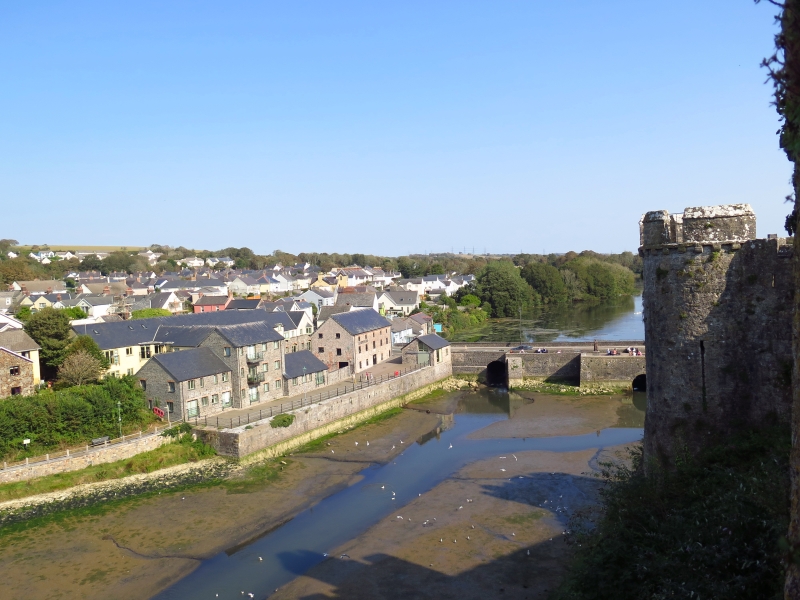
Location: On the N side of the estuary just W of Mill Bridge.
County: Pembrokeshire
Town: Pembroke
Community: Pembroke (Penfro)
Community: Pembroke
Built-Up Area: Pembroke
Traditional County: Pembrokeshire
Tagged with: Wharf
Quay wall extending upstream from the Mill Bridge, mid to late C19. The dominance of the port at Pembroke, both in the Haven and in the County, was established by C12 charters. Although outstripped by Haverfordwest and Milford Haven in late C18, Pembroke in the early C18 had reputedly nearly two hundred ships based at its port and, until the earlier C19, levied the customs of the Haven.
The quays are not apparent in C18 views, which suggests that loading was against the bridge or on the foreshore. On c. 1865 map the N quay wall exists only to SW of the warehouse now known as The Cornstore, with tidal foreshore up to the front wall of the warehouse, the E part of quay presumably built in late C19.
Long quay wall faced with squared stone. To W of a masonry joint, more regular squared blocks and the W end corner has rock-faced sandstone quoins. Rougher grey limestone squared masonry to E part, in front of the Cornstore. Steps to water by bridge.
Included for its special historic interest as part of the historic port of Pembroke, and for group value with the Mill Bridge and Town Quay opposite.
External links are from the relevant listing authority and, where applicable, Wikidata. Wikidata IDs may be related buildings as well as this specific building. If you want to add or update a link, you will need to do so by editing the Wikidata entry.


Other nearby listed buildings