Approximate Location Map
Large Map »
Latitude: 51.4615 / 51°27'41"N
Longitude: -3.4514 / 3°27'4"W
OS Eastings: 299268
OS Northings: 174618
OS Grid: SS992746
Mapcode National: GBR HK.M4LF
Mapcode Global: VH6F8.4J8F
Plus Code: 9C3RFG6X+JF
Entry Name: Town Walls
Listing Date: 5 December 1963
Last Amended: 16 September 1999
Grade: II*
Source: Cadw
Source ID: 13181
Building Class: Defence
Also known as: Town Walls
ID on this website: 300013181
Location: On E side of The Butts, from rear of Mason's Arms, to bastion at SW angle, thence along N side of Town Mill Road.
County: Vale of Glamorgan
Community: Cowbridge with Llanblethian (Y Bont-faen a Llanfleiddan)
Community: Cowbridge with Llanblethian
Locality: Cowbridge
Built-Up Area: Cowbridge
Traditional County: Glamorgan
Tagged with: City walls
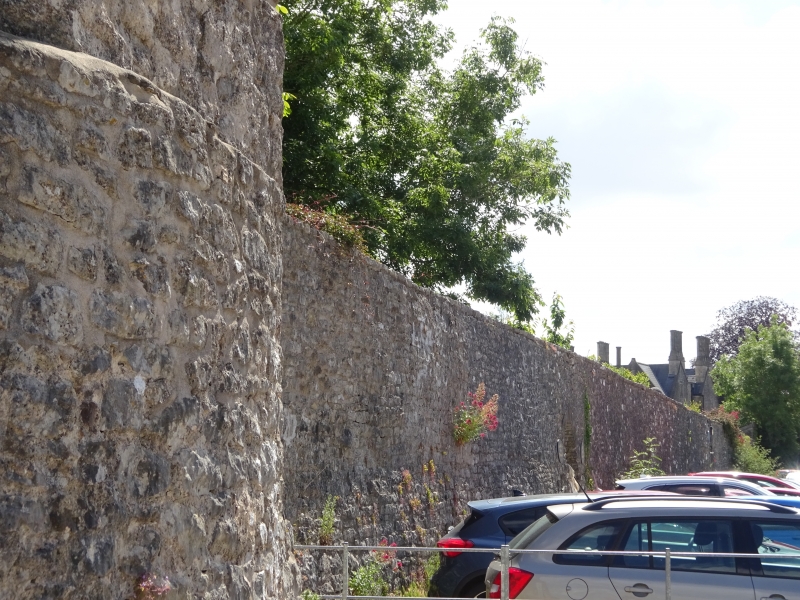
Earl Gilbert de Clare, Lord of Glamorgan, is thought to have directed in 1266 the building of protective walls round the boroughs of Cowbridge, Neath and Cardiff. The oldest parts of the present walls in Cowbridge probably date from early C14, and face The Butts; it is not certain how far the walls facing Town Mill Road are original. Rose Cottage and adjoining garden walls have almost certainly been built on the line of the walls, and probably incorporate the Town Walls in their own walling or foundations.
Stone rubble, about 3.5 metres high on average, formerly apparently rising to about 7.6 metres and with an internal wall walk. The walls in the Butts are castellated and have a bastion at their SW angle, circular in plan, with polygonal upper storey and was probably used as a summer-house in the post-medieval period. Doorway through to gardens, to S of Mason's Arms; facing gardens, inner retaining wall to walkway which is turfed. To E of bastion, walls pierced by 2 doorways, a round-headed one to W, and to E, doorway with Tudor head, and to N, facing gardens, stone rubble gate piers with moulded copings.
The walls extend to W, as garden walls on footing of medieval walls (See separate entry under Town Mill Road).
External links are from the relevant listing authority and, where applicable, Wikidata. Wikidata IDs may be related buildings as well as this specific building. If you want to add or update a link, you will need to do so by editing the Wikidata entry.


Other nearby listed buildings
