Approximate Location Map
Large Map »
Latitude: 51.7745 / 51°46'28"N
Longitude: -3.2995 / 3°17'58"W
OS Eastings: 310435
OS Northings: 209223
OS Grid: SO104092
Mapcode National: GBR YT.ZD5K
Mapcode Global: VH6CS.RNJJ
Plus Code: 9C3RQPF2+Q5
Entry Name: Nos 1-14 (consec) Collins Row
Listing Date: 24 July 1973
Last Amended: 15 May 2001
Grade: II
Source: Cadw
Source ID: 13546
Building Class: Domestic
ID on this website: 300013546
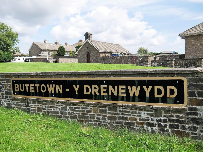
Location: Bute Town is situated SW of Rhymney Bridge, W of Llechryd and just E of the A469, reached by a short drive; Collins Row is the N terrace.
County: Caerphilly
Town: Rhymney
Community: Rhymney (Rhymni)
Community: Rhymney
Locality: Bute Town
Traditional County: Glamorgan
Tagged with: Building
Union Ironworks were established on the other (E) side of the Rhymney River c1800-02, soon becoming the property of the Crawshay Ironmasters, managed by Richard Johnson. In 1825 a new ironworks was begun on the opposite bank on land owned by the Marquis of Bute, with their notable Egyptian furnaces 'adapted from the most striking part of the ruins of Dandyra in Upper Egypt', built by McCulloch; in 1828 an exhibition of drawings and engravings of the structures was displayed at the Royal Academy. These terraces were built nearby to house the ironworkers. Constructed to a high standard, the plan was probably based on James Adams' planned village at Lowther in Cumbria of 1765. Originally conceived as a larger model village; the foundations of a fourth row were laid to S but the exhaustion of the ironworkings did not justify the development. On Rhymney Ironworks Company map dated 1838, the year after the company was formed though the map was later, the settlement is called New Town; it later became known as Bute Town. Pond to provide water to drive the blast water wheel is shown to W; this is still in existence though reshaped. OS map of 1873-5 shows the Rhymney Branch of the London and NW Railway passing to W. Since listing in 1973 and a renovation programme in 1979 the terraces have gradually recovered a more homogeneous appearance eg removal of pebbledash cladding from some exteriors and standardisation of windows into 2-pane horned sashes and doors now all boarded with a glazed panel. This applies only to frontages; to rear and sides windows have not been standardised. The original windows are however likely to have been similar to the small pane iron framed windows in the Museum on Lower Row and the masonry to have been rendered.
Terrace of 2 and 3 storey early C19 ironworkers’ houses in classical style, similar to terraces of Middle and Lower Rows, but whose symmetry is now incomplete due to demolition of Nos.15 and 16. Original plan has the two outer bays and central 3-storey bay all projecting with recessed bays between. Thus from NE (left) end, Nos.1 and 2, and centre bay, Nos.7, 8, 9, 10 all project. Each house except the central range has a single window range and door; the central 4 houses are in pairs, each pair share a 3 window range (centre windows blocked in each case) with outer doorways. Built of roughly coursed stone rubble with shallow pitched hipped roofs of stone slates, separate hipped roof to the central range, chunky ridge stacks mostly shared; very deep overhanging boarded eaves. Windows are horned sashes without glazing bars, yellow brick sills. Boarded doors, mostly recessed, have a glazed panel. Openings have slighly cambered heads with rough voussoirs, some with iron lintels showing, and surrounds.
Nos.1 and 2 at NE (left) end project; door to No.2 is to left; door to No.1 is in NE return giving a double-fronted appearance to the first bay, 1 stack. Nos.3, 4, 5, 6 are recessed: No.3 has door to left and Nos.4, 5 and 6 has doors to right, 3 stacks. Nos.7, 8, 9,10 comprise the projecting 3 storey centre block, 2 stacks. Nos.11,12,13,14 are recessed matching Nos.3,4,5,6: doors in Nos.11 and 12 to left; doors in Nos.13 and 14 to right, 3 stacks. Nos.15 and 16 were converted in C19 to form a Board School but have now been demolished. Outshuts and walled gardens to rear.
Original interior plan of two rooms on each floor, double depths, each with a fireplace and spiral staircase beside
Listed, notwithstanding external changes of character, as amongst the earliest planned industrial housing in the Welsh Valleys. Group value with other listed buildings at Bute Town.
External links are from the relevant listing authority and, where applicable, Wikidata. Wikidata IDs may be related buildings as well as this specific building. If you want to add or update a link, you will need to do so by editing the Wikidata entry.


Other nearby listed buildings
