Approximate Location Map
Large Map »
Latitude: 51.4746 / 51°28'28"N
Longitude: -3.701 / 3°42'3"W
OS Eastings: 281960
OS Northings: 176440
OS Grid: SS819764
Mapcode National: GBR H7.L7SX
Mapcode Global: VH5HN.S6SF
Plus Code: 9C3RF7FX+RJ
Entry Name: Walls of the Outer Basin and West Pier/Quay
Listing Date: 17 February 1998
Last Amended: 17 February 1998
Grade: II
Source: Cadw
Source ID: 19363
Building Class: Maritime
ID on this website: 300019363
Location: On the landward side of the Breakwater, to the E of Porthcawl town.
County: Bridgend
Town: Porthcawl
Community: Porthcawl
Community: Porthcawl
Locality: Porthcawl Harbour
Built-Up Area: Porthcawl
Traditional County: Glamorgan
Tagged with: Wharf
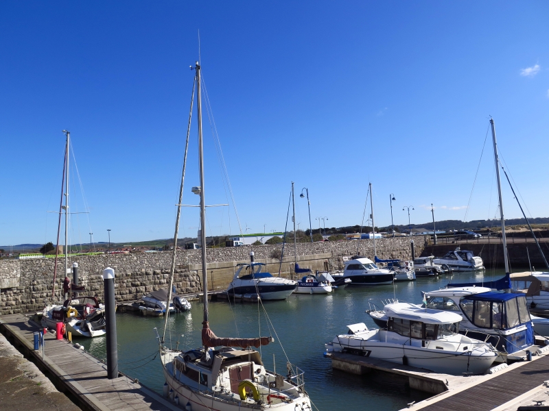
The first harbour, which became the outer Basin, was completed in 1828 following Act of Parliament 1825 authorising construction of both Dyffryn Llynfi Porthcawl Railway, a horse-drawn tramroad, and the dock, to provide an outlet for coal and iron from the Llynfi Valley. Original dock was a rectangular tidal basin protected by a short breakwater with entrance in E side and open to N. Large warehouse, Jennings warehouse, erected SW on West Quay. Plan of 1846 shows W, S and possibly part of E walls largely as at present. Dock was further developed following Act of 1840 which provided new facilities for loading coal, extending dock by rebuilding N wall 50 yds (45.7 metres) N, and excavating depths. Extensive further development authorised by Act of Parliament of 1864 involved construction of additional large new dock to N with entrance gates at N end of existing tidal outer basin, resiting the entrance from E to S, erection of inner pier along E side and extension of breakwater by 100 yds (91.4 metres), as shown in Plan of 1866. This expansion took place under John Brogden and Sons who became owners of Tondu Ironworks in 1853 and began developing coal mining in the Ogmore Valley and accounted for over a half of outgoing cargoes. Following enlargement of docks trade increased greatly; in 1871 165,000 tons (168,300 tonnes) were shipped and in 1874 over 700 vessels docked. Most trade was within the British Isles and most vessels came in empty or in ballast which was tipped on nearby dunes. Opening of Port Talbot and Barry Docks in 1898, providing better and larger facilities and safer access, created immediate reduction in trade and docks closed in 1906. Filling in N Inner Basin commenced in 1914 but was abandoned owing to outbreak of World War I. It became Salt Lake Bathing Pool in 1920s when the area developed as Cosy Corner after the name of a cinema adjacent to the Jennings Warehouse. Finally filled in during Second World War. The West Pier or Quay abuts the S wall of the original Outer Basin, the E side remodelled in 1866 when the Dock entrance was moved to S and thus forming the E quay of the Dock entrance. OS survey 1876 shows railway along W side of outer basin.
The Outer Basin is rectangular, originally built of giant regularly coursed dressed limestone blocks, at S and W directly onto outcropping rock; later rockfaced stone and later small stone patching and repairs. S and W walls are mainly of giant coursed blocks. Later N wall is of rock-faced stone, with clear infill where lockgates were removed when Inner Basin was decommissioned. Further alterations can be traced in masonry of E wall. Stone quaysides, in places covered with concrete or ashphalt, have iron and stone bollards and mooring rings; original steps at NW corner, 2 steps created out of each stone block; an apparently original buttress adjacent; culverts and a blocked arched opening in W wall. Seawall to E has blocks on inner face decoratively snecked; seaward side is rockfaced, mostly large coursed blocks battered to base; raised parapet. The West Pier or Quay in front of Jennings Warehouse is built of coursed dressed blocks with section S of rock-faced stone; grooves for gates, which are apparently submerged and visible in silt at low water.
Included as an early C19 maritime structure from the earliest days of the port of Porthcawl, for its exceptional importance in the history of the development of Porthcawl, and for group value with Jennings Warehouse, the Breakwater, the Old Customs House, the Look-out Tower, the Lighthouse.
External links are from the relevant listing authority and, where applicable, Wikidata. Wikidata IDs may be related buildings as well as this specific building. If you want to add or update a link, you will need to do so by editing the Wikidata entry.


Other nearby listed buildings
