History in Structure

Ffrwd Bridge

A Grade II Listed Building in Llanfynydd, Flintshire

More Photos »
Approximate Location Map
Large Map »

Coordinates

Latitude: 53.0905 / 53°5'25"N

Longitude: -3.0425 / 3°2'32"W

OS Eastings: 330280

OS Northings: 355320

OS Grid: SJ302553

Mapcode National: GBR 73.9CFV

Mapcode Global: WH88R.7LG3

Plus Code: 9C5R3XR5+62

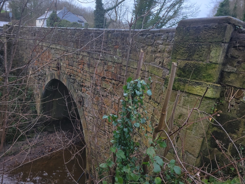
Entry Name: Ffrwd Bridge

Listing Date: 23 February 1998

Last Amended: 23 February 1998

Grade: II

Source: Cadw

Source ID: 19389

Building Class: Transport

ID on this website: 300019389

Location: Situated c0.75 km W of Sydallt where the B5102 crosses the River Alyn.

County: Flintshire

Community: Llanfynydd

Community: Llanfynydd

Locality: Ffrwd

Traditional County: Denbighshire

Tagged with: Bridge Road bridge

Find accommodation in
Ffrith

History

Probably built early C19.

Exterior

Roughly squared and coursed rubble with a flat stone parapet. The single-arch span has a dressed stone surround. There are buttresses at each end of the bridge and a dressed stone string course. Two cast-iron tie-plates are visible on each side.

Reasons for Listing

Listed as a good example of an early C19 bridge.

External Links

External links are from the relevant listing authority and, where applicable, Wikidata. Wikidata IDs may be related buildings as well as this specific building. If you want to add or update a link, you will need to do so by editing the Wikidata entry.

Recommended Books

Other nearby listed buildings

  • II Rock Cottage
    Above the road as it goes downhill towards the River Alyn at Cefn y Bedd.
  • II Former Llay Hall Colliery Workshops
    Located in the group of former Llay Hall Colliery buildings inuse as an industrial estate east of Mold Road. The workshops are on the north side of the complex and are in use as stores.
  • II Former Llay Hall Colliery Chimney and Flue
    Located in the group of former Llay Hall Colliery buildings in use as an industrial estate east of Mold Road. The chimney is high on the slope to the west of the site, close to Mold Road.
  • II Church of Saint Mary
    On the N side of Brymbo.
  • II Former Llay Hall Collery Engine House
    Located in the group of former Llay Hall colliery buildings in use as an industrial estate east of Mold Road. The engine house is a large building at the middle of the group with a smaller wing attac
  • II Former Llay Hall Colliery Washery Building
    Located in the group of former Llay Hall Colliery buildings in use as an industrial estate east of Mold Road. The former washery is a large building converted to industrial workshops at the south-east
  • II Bryn Seion Chapel
    Alongside the road and prominently sited above the deep valley which forms the boundary between Broughton and Brymbo.
  • II Gatepiers at Bryn Iorcyn Manor
    Situated at the head of the drive which runs W to Bryn Iorcyn Manor House from Bryn Yorkin Road.

BritishListedBuildings.co.uk is an independent online resource and is not associated with any government department. All government data published here is used under licence. Please do not contact BritishListedBuildings.co.uk for any queries related to any individual listed building, planning permission related to listed buildings or the listing process itself.

British Listed Buildings is a Good Stuff website.