Approximate Location Map
Large Map »
Latitude: 51.5982 / 51°35'53"N
Longitude: -3.9954 / 3°59'43"W
OS Eastings: 261889
OS Northings: 190707
OS Grid: SS618907
Mapcode National: GBR GX.DB6P
Mapcode Global: VH4KG.P3N4
Plus Code: 9C3RH2X3+7R
Entry Name: Bridge over River Clyne known as 'Roman Bridge' (partly in Sketty community)
Listing Date: 15 November 1993
Last Amended: 29 October 1999
Grade: II
Source: Cadw
Source ID: 22572
Building Class: Transport
ID on this website: 300022572
Location: On the NW side of the junction between Mumbles Road and Mill Lane, and S of the entrance to Clyne Valley Country Park.
County: Swansea
Town: Swansea
Community: Mumbles (Y Mwmbwls)
Community: Mumbles
Locality: Blackpill
Built-Up Area: Swansea
Traditional County: Glamorgan
Tagged with: Bridge
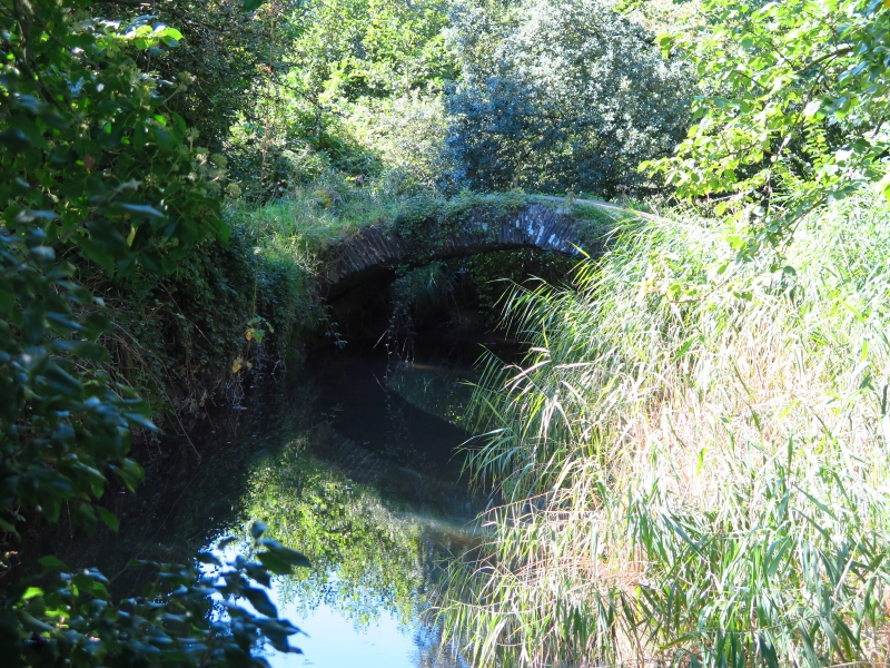
Probably an C18 road bridge despite its name.
A single-carriageway masonry bridge of which only the segmental arch-rings and soffit survive.
Included as the remains of an early road bridge.
External links are from the relevant listing authority and, where applicable, Wikidata. Wikidata IDs may be related buildings as well as this specific building. If you want to add or update a link, you will need to do so by editing the Wikidata entry.


Other nearby listed buildings
