Latitude: 51.4818 / 51°28'54"N
Longitude: -3.2915 / 3°17'29"W
OS Eastings: 310411
OS Northings: 176667
OS Grid: ST104766
Mapcode National: GBR HS.KW71
Mapcode Global: VH6FB.W0RV
Plus Code: 9C3RFPJ5+P9
Entry Name: Church Cottage
Listing Date: 7 August 2002
Grade: II
Source: Cadw
Source ID: 26824
Building Class: Domestic
ID on this website: 300026824
Location: Adjacent to the Church of St George, to west.
County: Vale of Glamorgan
Community: St. Georges-super-Ely (Sain Siorys)
Community: St. Georges-super-Ely
Locality: St Georges Super Ely
Traditional County: Glamorgan
Tagged with: Cottage
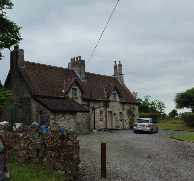
Probably c1860. Appears on First edition OS map 1879 as Church Cottage, which is still its name although in two units. A house on or near this site is shown on the Tithe Map of 1844.
Pair of cottages in Cottage Orne style. Of rubble with dressed stone dressings; steep-pitched roof of fishscale tiles(some plain tile replacements), terracotta coxcomb ridge tiles and overhanging eaves; stepped stone external gable stack to left, long narrow centre cross-ridge stack and paired angled brick chimneys end right. Single storey and attic. Main elevation faces garden; each cottage has a gabled dormer above a central plain doorway with hood, fishscale tiles retained to left; ground floor windows either side with slightly cambered arched heads; all glazing replaced. Rear elevation to lane has similar though smaller dormers and back doorways with flanking windows; single storey lean-to to left. Battered plinth.
Converted as maisonettes.
Listed as a C19 cottage of definite character, notwithstanding altered glazing, and for group value with the church.
External links are from the relevant listing authority and, where applicable, Wikidata. Wikidata IDs may be related buildings as well as this specific building. If you want to add or update a link, you will need to do so by editing the Wikidata entry.


Other nearby listed buildings