Approximate Location Map
Large Map »
Latitude: 52.9247 / 52°55'28"N
Longitude: -4.1275 / 4°7'38"W
OS Eastings: 257078
OS Northings: 338486
OS Grid: SH570384
Mapcode National: GBR 5P.MZTW
Mapcode Global: WH55L.KRR6
Plus Code: 9C4QWVFF+V2
Entry Name: Britannia Bridge
Listing Date: 26 September 2005
Last Amended: 26 September 2005
Grade: II
Source: Cadw
Source ID: 85367
ID on this website: 300085367
Location: At the N end of the harbour and standing between the town centre and the Cob.
County: Gwynedd
Town: Porthmadog
Community: Porthmadog
Community: Porthmadog
Built-Up Area: Porthmadog
Traditional County: Caernarfonshire
Tagged with: Road bridge
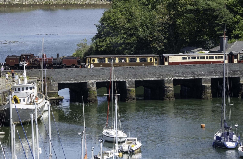
Built 1808-11 contemporary with the Great Embankment (The Cob), William Madocks' grand scheme to reclaim Traeth Mawr for agricultural land, and to carry a road on Madocks' proposed London-Dublin postal route. Construction was probably supervised by John Williams, agent to Madocks. The bridge acted as a tidal sluice, and retains its slots for tidal gates.
A double-carriageway 5-bay bridge, of large blocks of squared local stone laid in regular courses. The original construction is best observed on the N (landward) side. Segmental arches have freestone voussoirs, and keystones recessed. Prominent rounded cutwaters retain slots for tidal gates, and above them are shallow buttresses carried up to a raised band at the base of the parapet. The parapet spanning the river is C20, of coursed slate-stone. Above the abutments the original parapet has survived, which is lower, and curves out to round terminal piers, which on the E side abuts Bridge Cottage. On the S (harbour) side the bridge has been extended by widening of the deck to accommodate a footway, which is supported on the cutwaters. These cutwaters also retain slots for tidal gates. The C20 parapet is similar to the parapet on the N side.
Listed, notwithstanding later widening, as an integral component of William Madocks' grand reclamation scheme, as represented by the Cob, and for its contribution to the historical integrity of the harbour. The bridge retains important evidence for its original design and construction.
External links are from the relevant listing authority and, where applicable, Wikidata. Wikidata IDs may be related buildings as well as this specific building. If you want to add or update a link, you will need to do so by editing the Wikidata entry.


Other nearby listed buildings
