Latitude: 52.2421 / 52°14'31"N
Longitude: 0.7183 / 0°43'6"E
OS Eastings: 585691
OS Northings: 263921
OS Grid: TL856639
Mapcode National: GBR QF0.GF7
Mapcode Global: VHKD4.DXM1
Plus Code: 9F426PR9+V8
Entry Name: 6A, Honey Hill
Listing Date: 12 July 1972
Last Amended: 30 October 1997
Grade: II
Source: Historic England
Source ID: 1022549
English Heritage Legacy ID: 466919
ID on this website: 101022549
Location: Bury St Edmunds, West Suffolk, IP33
County: Suffolk
District: West Suffolk
Civil Parish: Bury St Edmunds
Built-Up Area: Bury St Edmunds
Traditional County: Suffolk
Lieutenancy Area (Ceremonial County): Suffolk
Church of England Parish: Bury St Edmunds St Mary
Church of England Diocese: St.Edmundsbury and Ipswich
Tagged with: Building
BURY ST EDMUNDS
TL8563NE HONEY HILL 639-1/11/445 (South side) 12/07/72 No.6A (Formerly Listed as: HONEY HILL (South side) No.6A including extension at south end in Sparhawk Street 'St David's')
GV II
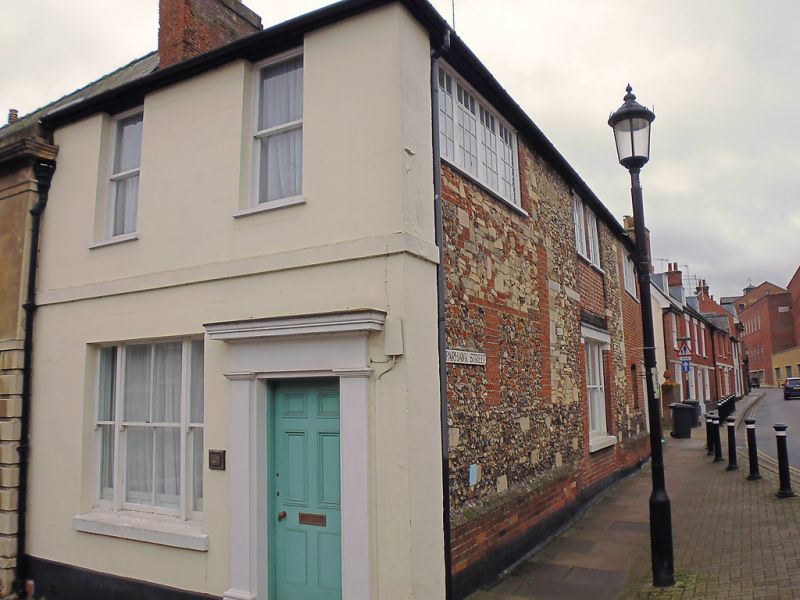
House, now offices. Early C19. For Thomas de Carle, stonemason. Walls in a mixture of red brick and stone blocks; render to the frontage on Honey Hill. Fully hipped slate roof. EXTERIOR: 2 storeys. 2 upper windows, formerly blocked, have replaced C20 sashes without glazing bars; one 3-light sash window to the ground storey with diminished side-lights and a single vertical glazing bar. A raised stucco band between the storeys. A 6-panel door with sunk panels in a plain heavy wood doorcase and architrave. The return wall to Sparhawk Street is in 3 sections, separated by straight joints with stone quoining, and suggests that the building developed in stages. The stone used may be partly reused Abbey stone, but much of it seems to have come from the nearby stonemason's yard. 4 window range: small-paned C20 casements, 4-light to the 2 outer and 2-light to the 2 inner windows. A tripartite sash window to the ground storey with a single vertical glazing-bar and a 6-panel door at the south end in a plain wood doorcase. INTERIOR: not inspected.
Listing NGR: TL8569163921
External links are from the relevant listing authority and, where applicable, Wikidata. Wikidata IDs may be related buildings as well as this specific building. If you want to add or update a link, you will need to do so by editing the Wikidata entry.


Other nearby listed buildings