Latitude: 52.1877 / 52°11'15"N
Longitude: -1.7091 / 1°42'32"W
OS Eastings: 419982
OS Northings: 254422
OS Grid: SP199544
Mapcode National: GBR 4LT.SV0
Mapcode Global: VHBY0.B89R
Plus Code: 9C4W57QR+39
Entry Name: 16, College Street
Listing Date: 9 February 1972
Last Amended: 4 April 1994
Grade: II
Source: Historic England
Source ID: 1187788
English Heritage Legacy ID: 366222
ID on this website: 101187788
Location: Old Town, Stratford-on-Avon, Warwickshire, CV37
County: Warwickshire
District: Stratford-on-Avon
Civil Parish: Stratford-upon-Avon
Built-Up Area: Stratford-upon-Avon
Traditional County: Warwickshire
Lieutenancy Area (Ceremonial County): Warwickshire
Church of England Parish: Stratford on Avon Holy Trinity
Church of England Diocese: Coventry
Tagged with: Building
STRATFORD-UPON-AVON
SP1954 COLLEGE STREET 604-1/5/67 (West side) 09/02/72 No.16 (Formerly Listed as: COLLEGE STREET (West side) Nos.13-15, 15A, 16 & 17)
GV II
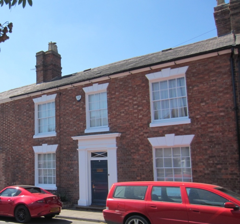
Town house. 1820s. Brick with buff headers and stucco dressings; slate roof with brick end stacks. Double-depth plan. Georgian style. 2 storeys; symmetrical 3-window range. Plain eaves. Entrance has Tuscan aedicule, overlight with decorative glazing bars to 3-fielded-panel door. Windows have sills, and rusticated wedge lintels with keys over 16-pane sashes. College Street is part of the development of the land on which the medieval priests' college stood until 1799, in an area of good quality early C19 housing. (Bearman R: Stratford-upon-Avon: A History of its Streets and Buildings: Nelson: 1988-: 66).
Listing NGR: SP1998254422
External links are from the relevant listing authority and, where applicable, Wikidata. Wikidata IDs may be related buildings as well as this specific building. If you want to add or update a link, you will need to do so by editing the Wikidata entry.


Other nearby listed buildings