Latitude: 52.3363 / 52°20'10"N
Longitude: -2.2788 / 2°16'43"W
OS Eastings: 381099
OS Northings: 270949
OS Grid: SO810709
Mapcode National: GBR 0C0.DPH
Mapcode Global: VH920.GJ4V
Plus Code: 9C4V8PPC+GF
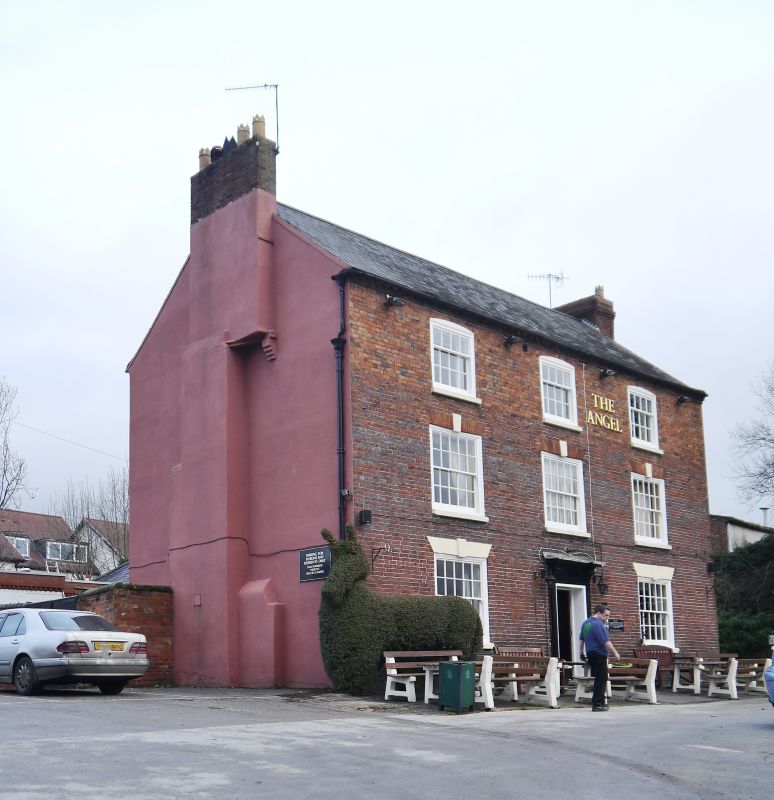
Entry Name: The Angel Public House
Listing Date: 10 March 1975
Last Amended: 11 October 1991
Grade: II
Source: Historic England
Source ID: 1209475
English Heritage Legacy ID: 393389
ID on this website: 101209475
Location: Stourport-on-Severn, Wyre Forest, Worcestershire, DY13
County: Worcestershire
District: Wyre Forest
Civil Parish: Stourport-on-Severn
Built-Up Area: Stourport-on-Severn
Traditional County: Worcestershire
Lieutenancy Area (Ceremonial County): Worcestershire
Church of England Parish: Stourport-on-Severn and Wilden
Church of England Diocese: Worcester
Tagged with: Pub
STOURPORT ON SEVERN
SO8170NW SEVERNSIDE 589-1/13/72 (North side) 10/03/75 The Angel Public House (Formerly Listed as: SEVERN SIDE The Angel Hotel)
GV II
Public House, probably in use as an inn since the mid-C18. Probably substantially of the mid C18, though extended in the later C18 with the growth of Stourport as a new town. Brick with Welsh slate roof. 3-storeyed, 3 bays with central doorway in pedimented case with consoles carrying entablature. Windows on ground and first floor are wide 20-pane sashes with flat arched rubbed brick heads with keystones. A change of brickwork, and different window types suggest that the upper storey was added to an existing building at the end of the C18. The windows here are 16-pane sashes with single ring segmentally arched heads. Dentilled eaves band, large projecting stack to east, smaller, possibly later stack on west gable. Early descriptions of "Stourmouth" refer to an inn on the river as one of the few buildings to pre-date the establishment of the new town. It seems likely that the Angel is the successor of that early inn, and it certainly appears on an engraving of the early canal structures of 1773. (Porteous JD: Canal Ports: The Urban Achievement of the Canal Age: London: 1977-: 83-105).
Listing NGR: SO8110370954
External links are from the relevant listing authority and, where applicable, Wikidata. Wikidata IDs may be related buildings as well as this specific building. If you want to add or update a link, you will need to do so by editing the Wikidata entry.


Other nearby listed buildings