Approximate Location Map
Large Map »
Latitude: 51.9919 / 51°59'30"N
Longitude: -2.1577 / 2°9'27"W
OS Eastings: 389268
OS Northings: 232620
OS Grid: SO892326
Mapcode National: GBR 1JR.1BB
Mapcode Global: VH93T.K65B
Plus Code: 9C3VXRRR+QW
Entry Name: Tudor Cottage
Listing Date: 4 March 1952
Grade: II
Source: Historic England
Source ID: 1282743
English Heritage Legacy ID: 376861
Also known as: 1 Lilley's Alley
ID on this website: 101282743
Location: Tewkesbury, Gloucestershire, GL20
County: Gloucestershire
District: Tewkesbury
Civil Parish: Tewkesbury
Built-Up Area: Tewkesbury
Traditional County: Gloucestershire
Lieutenancy Area (Ceremonial County): Gloucestershire
Church of England Parish: Tewkesbury St Mary the Virgin (Tewkesbury Abbey)
Church of England Diocese: Gloucester
TEWKESBURY
SO8932 LILLEY'S ALLEY
859-1/6/279 (East side)
04/03/52 No.1
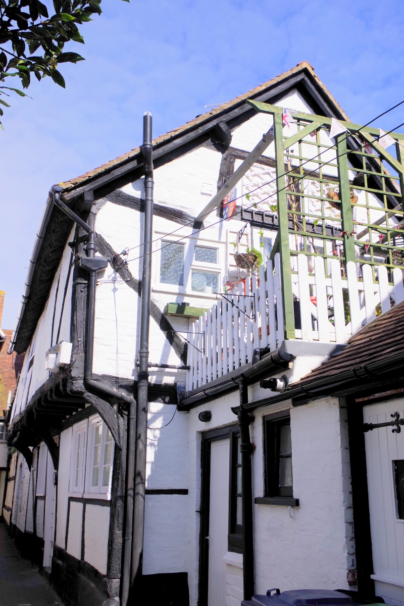
Tudor Cottage
GV II
House. Probably early/mid C16. Timber-frame with tension
bracing, stone, brick, tile roof, brick stack. A wide-frontage
house jettied into Lilley's Alley, and backing up to The
Berkeley Arms (qv) in Church Street. The 2-storey jettied
front has brick-filled braced framing, with plaster infill to
first floor, and all on a stone plinth, with a recess at the
left, probably a former basement access. Small 2-light
casement at first floor above three 2-light casements at
ground floor, and C20 door towards left. Framing has a large
plate on the plinth for most of its length. 3 jetty brackets.
Brick ridge stack to left. Gable to N is square panel framing,
with the corner post leaning back from the front wall, and a
small plain light inserted. S gable has remains of framing
with brick infill, and, at first-floor level, a French door to
a terrace. There is a lower wing to the right, linking with
the adjoining property (Claypipes (qv)). INTERIOR not
inspected.
Listing NGR: SO8926832620
External links are from the relevant listing authority and, where applicable, Wikidata. Wikidata IDs may be related buildings as well as this specific building. If you want to add or update a link, you will need to do so by editing the Wikidata entry.


Other nearby listed buildings
