History in Structure

Telephone Call-box to N of parish Church

A Grade II Listed Building in Llancarfan, Vale of Glamorgan

More Photos »
Approximate Location Map
Large Map »

Coordinates

Latitude: 51.4462 / 51°26'46"N

Longitude: -3.3778 / 3°22'39"W

OS Eastings: 304347

OS Northings: 172811

OS Grid: ST043728

Mapcode National: GBR HN.N52X

Mapcode Global: VH6F9.DXN7

Plus Code: 9C3RCJWC+FV

Entry Name: Telephone Call-box to N of parish Church

Listing Date: 22 June 1990

Last Amended: 8 September 1995

Grade: II

Source: Cadw

Source ID: 13440

Building Class: Communications

ID on this website: 300013440

Location: At the roadside close to the boundary wall along the N side of the churchyard St Illtyd's parish church.

County: Vale of Glamorgan

Community: Llancarfan

Community: Llancarfan

Locality: LLantrithyd

Traditional County: Glamorgan

Tagged with: Red telephone box K6 telephone box

Find accommodation in
Llancarfan

History

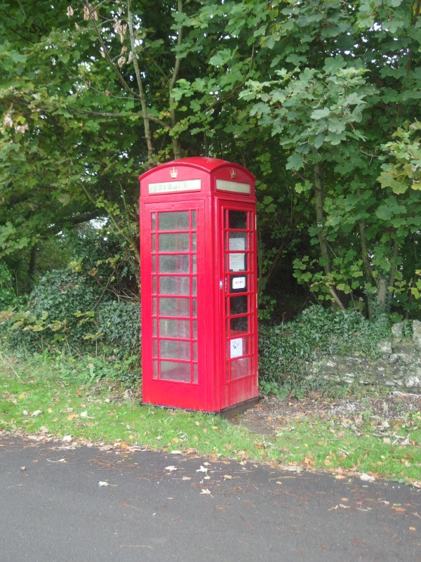
EIIR, K6, type. Square red kiosk of cast-iron construction to the standard design of Giles Gilbert Scott, architect of London. This example is by Carron Foundry Stirlingshire.

Exterior

Domed roof with 4 lunettes containing embossed crowns over red lettered opals and ventilation slits. Raised surrounds to sides and door with marginal glazing bars to horizontal glazing.

Reasons for Listing

Included for its special location in the Conservation Area.

External Links

External links are from the relevant listing authority and, where applicable, Wikidata. Wikidata IDs may be related buildings as well as this specific building. If you want to add or update a link, you will need to do so by editing the Wikidata entry.

Recommended Books

Other nearby listed buildings

  • II* St Illtyd's Parish Church
    Located at the centre of the Village, W of Llantrithyd Place.
  • II Ruins of Llantrithyd Place
    Located SW of the churchyard of Llantrithyd parish church, fronting the Nant Llantrithyd to the SW.
  • II Circular Pigsty at the Meadows
    Located on the S side of the road junction, opposite Tre-Aubrey house.
  • II Ty-draw Farmhouse
    About 1.2km west of Llantrithyd Church to S of minor road between Llantrithyd and St Hilary. Entrance faces south.
  • II Agricultural Range at Ty-draw Farm
    To W of Ty Draw Farmhouse, which is about 1.2km E of Llantrithyd Church, on minor road between Llantrithyd and St Hilary.
  • II Garehouse at Llanfythin Farmhouse
    Located to the N of Llancarfan village located on a private lane leading W from the Llancarfan- Bonvilston Road, immediately in front of Llanfythin Farmhouse.
  • II Llanfythin Farmhouse
    Farmhouse set on the W side of the Nant Llancarfan valley 1km due N of the village of Llancarfan.
  • II Llanfythin Mill
    Located on the N side of the Nant Llancarfan Stream, N of Llancarfan village, SW of Garnllwyd Farmhouse, E of Bonvilston-Llancarfan Road.

BritishListedBuildings.co.uk is an independent online resource and is not associated with any government department. All government data published here is used under licence. Please do not contact BritishListedBuildings.co.uk for any queries related to any individual listed building, planning permission related to listed buildings or the listing process itself.

British Listed Buildings is a Good Stuff website.