Approximate Location Map
Large Map »
Latitude: 51.4675 / 51°28'3"N
Longitude: -3.1814 / 3°10'52"W
OS Eastings: 318033
OS Northings: 174948
OS Grid: ST180749
Mapcode National: GBR KHR.MW
Mapcode Global: VH6FD.SCZT
Plus Code: 9C3RFR99+2C
Entry Name: Shelter in Grange Gardens
Listing Date: 18 November 1997
Last Amended: 18 November 1997
Grade: II
Source: Cadw
Source ID: 19089
Building Class: Gardens, Parks and Urban Spaces
ID on this website: 300019089
Location: At E end of gardens at corner of Corporation Road and Holmedale Street.
County: Cardiff
Community: Grangetown
Community: Grangetown
Built-Up Area: Cardiff
Traditional County: Glamorgan
Tagged with: Architectural structure
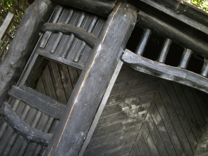
Probably contemporary with gardens.
Rustic shelter of tree trunks and branches, slate roof, broad octagonal plan. Broad segmentally arched entrance, windows to front and sides of octagon.
Listed as eye-catching rustic building in urban setting.
External links are from the relevant listing authority and, where applicable, Wikidata. Wikidata IDs may be related buildings as well as this specific building. If you want to add or update a link, you will need to do so by editing the Wikidata entry.


Other nearby listed buildings
