Latitude: 52.3361 / 52°20'9"N
Longitude: -2.2776 / 2°16'39"W
OS Eastings: 381183
OS Northings: 270924
OS Grid: SO811709
Mapcode National: GBR 0C0.F0Q
Mapcode Global: VH920.GKS0
Plus Code: 9C4V8PPC+CX
Entry Name: 1 and 2, Cheapside
Listing Date: 19 June 1991
Grade: II
Source: Historic England
Source ID: 1209932
English Heritage Legacy ID: 393316
ID on this website: 101209932
Location: Stourport-on-Severn, Wyre Forest, Worcestershire, DY13
County: Worcestershire
District: Wyre Forest
Civil Parish: Stourport-on-Severn
Built-Up Area: Stourport-on-Severn
Traditional County: Worcestershire
Lieutenancy Area (Ceremonial County): Worcestershire
Church of England Parish: Stourport-on-Severn and Wilden
Church of England Diocese: Worcester
Tagged with: Building
STOURPORT ON SEVERN
SO8170NW CHEAPSIDE 589-1/13/10 (East side) 19/06/91 Nos.1 AND 2
GV II
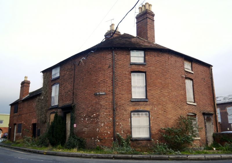
Pair of houses, all that remains of a longer terrace. c1800. Brick with plain tiled roof. 3-storeyed, 5 bays, divided into 2 unequal units and built on a curve round the street corner. 4-panelled doors with overlights have pedimented cases with flat entablatures and panelled rebates, the western door flanked by flush framed 16-light sash windows with segmentally arched brick heads. One blocked window on ground floor. Upper windows are also 16-pane sashes with segmentally arched heads (12-panes on angle, 8 to attic storey). Dentilled eaves, gable end stacks. Small added wing to north. Probably built in association with the New Basin, 1806-1810.
Listing NGR: SO8118370924
External links are from the relevant listing authority and, where applicable, Wikidata. Wikidata IDs may be related buildings as well as this specific building. If you want to add or update a link, you will need to do so by editing the Wikidata entry.


Other nearby listed buildings